 vesseltracker.com
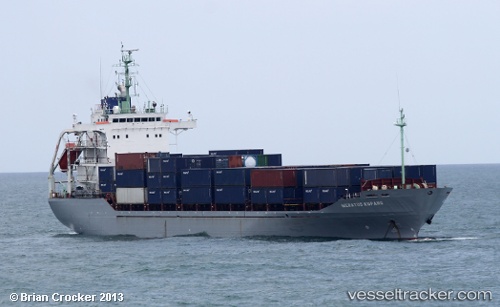
Meratus Kupang
Current StatusWhere is the vessel?
Meratus Kupang is currently in 18 nm E of TANJUNG PEMANCINGAN, based on AIS data received about 1h ago.
Latest AIS update:
Current position: 3.14518° S, 116.57107° E (18 nm E of TANJUNG PEMANCINGAN)
Average speed (last 7 days): Loading…
Average speed (last 30 days): Loading…
Vessel profile: Meratus Kupang is a Container Ship with dimensions 23m x 129m.
This page combines live AIS, route history, probable destination signals, nearby traffic, and port activity for practical vessel monitoring.
The current position of vessel Meratus Kupang is -3.14518 lat / 116.57107 lng. Updated: 2026-04-06 15:44:11 UTCNearest reference points:
- Near TANJUNG PEMANCINGAN
- 57 nm NE of TANJUNG PEMANCINGAN
- 12 nm SE of Bunati
Details:
Live Vessel Meratus Kupang Analytics (details, animations, etc.)
Recent AIS points (UTC):
2026-04-05 21:23:13 UTC · -5.61977, 114.51709 · SOG 11.4 kn · COG 56°2026-04-05 21:23:13 UTC · -5.61977, 114.51709 · SOG 11.4 kn · COG 56°
2026-04-06 13:58:35 UTC · -3.45503, 116.48967 · SOG 10.7 kn · COG 13°
2026-04-06 15:44:11 UTC · -3.14518, 116.57107 · SOG 11.2 kn · COG 14°