 vesseltracker.com
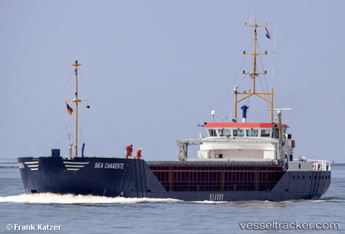
 Sea Charente
Current Status
Where is the vessel?
Sea Charente is currently in Near Canvey Island, based on AIS data received about 2h ago.
Latest AIS update:
Current position: 51.50471° N, 0.54986° E (Near Canvey Island)
Average speed (last 7 days): Loading…
Average speed (last 30 days): Loading…
Vessel profile: Sea Charente is a General Cargo Ship with dimensions 82m x 11m.
This page combines live AIS, route history, probable destination signals, nearby traffic, and port activity for practical vessel monitoring.
The current position of vessel Sea Charente is 51.50471 lat / 0.54986 lng. Updated: 2026-03-27 15:37:39 UTCNearest reference points:
- Near GILLINGHAM
- Near Gravesend
- Near HEYBRIDGE
Currently sailing under the flag of Netherlands ![]()
Sea Charente built in 1996 year
Deadweight:
2100 tDetails:
Live Vessel Sea Charente Analytics (details, animations, etc.)
Recent AIS points (UTC):
2026-03-27 10:06:41 UTC · 51.66808, 1.96699 · SOG 9.1 kn · COG -1°2026-03-27 12:03:39 UTC · 51.51197, 1.53738 · SOG 9.9 kn · COG 253°
2026-03-27 14:16:00 UTC · 51.48642, 0.94071 · SOG 10.3 kn · COG 284°
2026-03-27 15:37:39 UTC · 51.50471, 0.54986 · SOG 11.1 kn · COG 272°