 vesseltracker.com
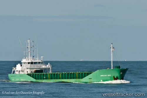
 FLUVIUS AXE
Current Status
Where is the vessel?
FLUVIUS AXE is currently in Near PAPENDRECHT, based on AIS data received about 1h ago.
Latest AIS update:
Current position: 51.81847° N, 4.70107° E (Near PAPENDRECHT)
Average speed (last 7 days): Loading…
Average speed (last 30 days): Loading…
Vessel profile: FLUVIUS AXE is a General Cargo Ship with dimensions 88m x 12m.
This page combines live AIS, route history, probable destination signals, nearby traffic, and port activity for practical vessel monitoring.
The current position of vessel FLUVIUS AXE is 51.81847 lat / 4.70107 lng. Updated: 2026-03-28 05:23:27 UTCNearest reference points:
- Near PAPENDRECHT
- Near LEKKERKERK
- Near Lage Zwaluwe
Currently sailing under the flag of Barbados ![]()
FLUVIUS AXE built in 1998 year
Deadweight:
3193 tDetails:
Live Vessel FLUVIUS AXE Analytics (details, animations, etc.)
Recent AIS points (UTC):
2026-03-27 23:32:28 UTC · 51.81849, 4.70105 · SOG 0 kn · COG 91°2026-03-28 02:05:27 UTC · 51.81853, 4.70099 · SOG 0 kn · COG 91°
2026-03-28 03:38:29 UTC · 51.81852, 4.70101 · SOG 0 kn · COG 91°
2026-03-28 05:23:27 UTC · 51.81847, 4.70107 · SOG 0 kn · COG 91°