 vesseltracker.com
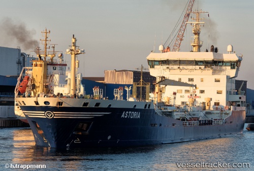
 ASTORIA
Current Status
Where is the vessel?
ASTORIA is currently in 25 nm SE of Matua island, based on AIS data received about 1h ago.
Latest AIS update:
Current position: 47.67333° N, 153.60500° E (25 nm SE of Matua island)
Average speed (last 7 days): Loading…
Average speed (last 30 days): Loading…
Vessel profile: ASTORIA is a Chemical/Oil Products Tanker with dimensions 21m x 137m.
This page combines live AIS, route history, probable destination signals, nearby traffic, and port activity for practical vessel monitoring.
The current position of vessel ASTORIA is 47.67333 lat / 153.60500 lng. Updated: 2026-04-19 06:20:27 UTCCurrently sailing under the flag of Russia ![]()
ASTORIA built in 1999 year
Deadweight:
12712 tDetails:
Live Vessel ASTORIA Analytics (details, animations, etc.)
Recent AIS points (UTC):
2026-04-19 00:03:31 UTC · 47.02728, 152.78613 · SOG 8.7 kn · COG 38°2026-04-19 02:26:29 UTC · 47.30333, 153.06168 · SOG 8 kn · COG -1°
2026-04-19 03:53:30 UTC · 47.45333, 153.23167 · SOG 7 kn · COG -1°
2026-04-19 06:20:27 UTC · 47.67333, 153.60500 · SOG 8 kn · COG -1°