 vesseltracker.com
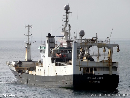
Don Alfonso
Current StatusWhere is the vessel?
Don Alfonso is currently in Near Huachipato, based on AIS data received about 1h ago.
Latest AIS update:
Current position: 36.72748° S, 73.13150° W (Near Huachipato)
Average speed (last 7 days): Loading…
Average speed (last 30 days): Loading…
Vessel profile: Don Alfonso is a Fish Carrier with dimensions 13m x 74m.
This page combines live AIS, route history, probable destination signals, nearby traffic, and port activity for practical vessel monitoring.
The current position of vessel Don Alfonso is -36.72748 lat / -73.13150 lng. Updated: 2026-04-17 17:46:05 UTCNearest reference points:
- Near Arauco
- 28 nm W of Pichilemu
Details:
Live Vessel Don Alfonso Analytics (details, animations, etc.)
Recent AIS points (UTC):
2026-04-17 12:21:53 UTC · -36.72746, -73.13152 · SOG 0 kn · COG 38°2026-04-17 14:03:17 UTC · -36.72747, -73.13150 · SOG 0 kn · COG 38°
2026-04-17 15:24:08 UTC · -36.72749, -73.13153 · SOG 0 kn · COG 35°
2026-04-17 17:46:05 UTC · -36.72748, -73.13150 · SOG 0 kn · COG 34°