 vesseltracker.com
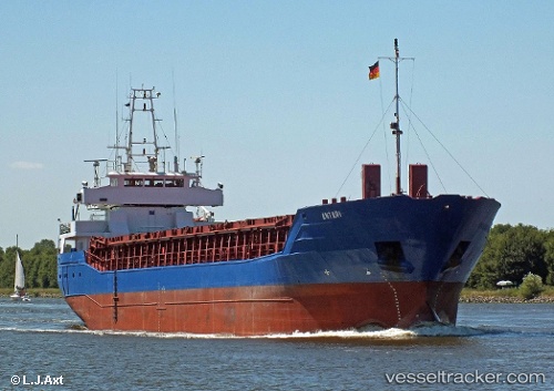
Vessel ANTARI IMO: 9171084, MMSI: 314652000 General Cargo Ship
UTC, 31.74688, 34.30528, course: 358, speed: 0
UTC, 31.82175, 34.66999, course: 358, speed: 4.6
2026-03-24 17:24:25 UTC, 31.74701, 34.30520, course: 358, speed: 0.4
Live Vessel ANTARI Analytics (details, animations, etc.)
Live AIS position: UTC. 12 nm NW of ASHKELON), updated 2026-03-24 17:24:25 UTC.Find the position of the vessel ANTARI on the map. The latter are known coordinates and path.
marine traffic ship tracker show on live map
The current position of vessel ANTARI is 31.74701 lat / 34.30520 lng. Updated: 2026-03-24 17:24:25 UTCCurrently sailing under the flag of Barbados
ANTARI built in 1998 year
Deadweight:
3700 tDetails:
Last coordinates of the vessel:
UTC, 31.84323, 34.64216, course: 358, speed: 0.9UTC, 31.74688, 34.30528, course: 358, speed: 0
UTC, 31.82175, 34.66999, course: 358, speed: 4.6
2026-03-24 17:24:25 UTC, 31.74701, 34.30520, course: 358, speed: 0.4