 vesseltracker.com
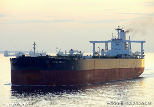
Ugo Ocha
Current StatusWhere is the vessel?
Ugo Ocha is currently in 25 nm N of Scauri Alto, based on AIS data received about 11h ago.
Latest AIS update:
Current position: 37.18153° N, 11.85953° E (25 nm N of Scauri Alto)
Average speed (last 7 days): Loading…
Average speed (last 30 days): Loading…
Vessel profile: Ugo Ocha is a Crude Oil Tanker with dimensions 60m x 333m.
This page combines live AIS, route history, probable destination signals, nearby traffic, and port activity for practical vessel monitoring.
The current position of vessel Ugo Ocha is 37.18153 lat / 11.85953 lng. Updated: 2026-04-18 20:15:06 UTCNearest reference points:
- 13 nm N of Qulaybiyah
- 32 nm N of Qulaybiyah
- Near MARSALA
Details:
Live Vessel Ugo Ocha Analytics (details, animations, etc.)
Recent AIS points (UTC):
2026-04-18 20:15:06 UTC · 37.18153, 11.85953 · SOG 12 kn · COG 133°2026-04-18 20:15:06 UTC · 37.18153, 11.85953 · SOG 12 kn · COG 133°
2026-04-18 20:15:06 UTC · 37.18153, 11.85953 · SOG 12 kn · COG 133°