 vesseltracker.com
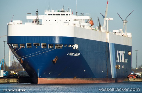
 LIBRA LEADER
Current Status
Where is the vessel?
LIBRA LEADER is currently in 64 nm SW of Puerto Jimenez, based on AIS data received less than 1h ago.
Latest AIS update:
Current position: 8.06667° N, 84.28667° W (64 nm SW of Puerto Jimenez)
Average speed (last 7 days): Loading…
Average speed (last 30 days): Loading…
Vessel profile: LIBRA LEADER is a Vehicles Carrier with dimensions m x m.
This page combines live AIS, route history, probable destination signals, nearby traffic, and port activity for practical vessel monitoring.
The current position of vessel LIBRA LEADER is 8.06667 lat / -84.28667 lng. Updated: 2026-04-19 15:32:28 UTCNearest reference points:
- 67 nm SW of Sámara
- Near Chiriquí Grande
- 27 nm W of Playa Conchal
Currently sailing under the flag of Liberia ![]()
Details:
Live Vessel LIBRA LEADER Analytics (details, animations, etc.)
Recent AIS points (UTC):
2026-04-19 11:54:18 UTC · 8.56137, -85.29991 · SOG 17.9 kn · COG 117°2026-04-19 13:38:24 UTC · 8.32506, -84.81510 · SOG 18.8 kn · COG 116°
2026-04-19 14:14:26 UTC · 8.24167, -84.64333 · SOG 18 kn · COG -1°
2026-04-19 15:32:28 UTC · 8.06667, -84.28667 · SOG 18 kn · COG -1°