 vesseltracker.com
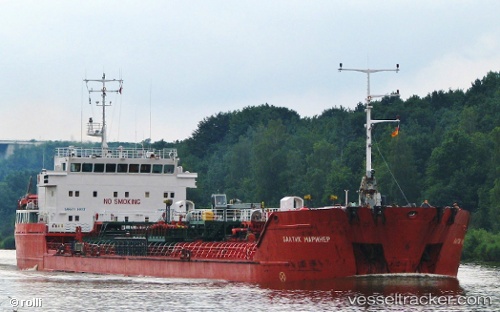
 ALI NAJAFOV
Current Status
Where is the vessel?
ALI NAJAFOV is currently in Near Kumport, based on AIS data received about 1h ago.
Latest AIS update:
Current position: 40.94880° N, 28.78551° E (Near Kumport)
Average speed (last 7 days): Loading…
Average speed (last 30 days): Loading…
Vessel profile: ALI NAJAFOV is a Crude Oil Tanker with dimensions m x m.
This page combines live AIS, route history, probable destination signals, nearby traffic, and port activity for practical vessel monitoring.
The current position of vessel ALI NAJAFOV is 40.94880 lat / 28.78551 lng. Updated: 2026-04-15 20:17:04 UTCNearest reference points:
- Near Kumport
- Near Küçükçekmece
- Near Ambarli
Currently sailing under the flag of Saint Kitts and Nevis ![]()
Details:
Live Vessel ALI NAJAFOV Analytics (details, animations, etc.)
Recent AIS points (UTC):
2026-04-15 14:09:04 UTC · 40.94848, 28.78564 · SOG 0 kn · COG -1°2026-04-15 15:59:05 UTC · 40.94840, 28.78570 · SOG 0 kn · COG 65°
2026-04-15 17:35:07 UTC · 40.94862, 28.78553 · SOG 0 kn · COG 70°
2026-04-15 20:17:04 UTC · 40.94880, 28.78551 · SOG 0 kn · COG 79°