 vesseltracker.com
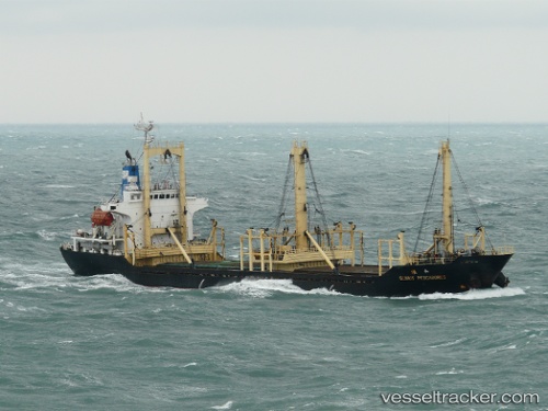
 NORAN
NORAN
Current Status
Where is the vessel?
NORAN is currently in Near Romano Port, based on AIS data received about 1h ago.
Latest AIS update:
Current position: 41.37488° N, 19.42242° E (Near Romano Port)
Average speed (last 7 days): Loading…
Average speed (last 30 days): Loading…
Vessel profile: NORAN is a General Cargo with dimensions m x m.
This page combines live AIS, route history, probable destination signals, nearby traffic, and port activity for practical vessel monitoring.
The current position of vessel NORAN is 41.37488 lat / 19.42242 lng. Updated: 2026-04-18 14:01:01 UTCNearest reference points:
- Near Durres
- 22 nm W of Fier
- Near TIVAT
Currently sailing under the flag of Saint Kitts and Nevis ![]()
Details:
Live Vessel NORAN Analytics (details, animations, etc.)
Recent AIS points (UTC):
2026-04-18 07:56:18 UTC · 41.37487, 19.42239 · SOG 0 kn · COG 240°2026-04-18 09:47:18 UTC · 41.37491, 19.42238 · SOG 0 kn · COG 240°
2026-04-18 12:18:58 UTC · 41.37495, 19.42240 · SOG 0 kn · COG 240°
2026-04-18 14:01:01 UTC · 41.37488, 19.42242 · SOG 0 kn · COG 240°