 vesseltracker.com
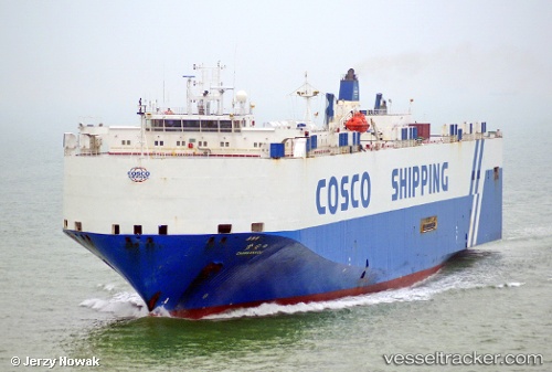
Chang An Kou
Current StatusWhere is the vessel?
Chang An Kou is currently in 160 nm E of Diego Garcia, based on AIS data received about 1h ago.
Latest AIS update:
Current position: 7.79610° S, 75.11768° E (160 nm E of Diego Garcia)
Average speed (last 7 days): Loading…
Average speed (last 30 days): Loading…
Vessel profile: Chang An Kou is a Vehicles Carrier with dimensions 31m x 176m.
This page combines live AIS, route history, probable destination signals, nearby traffic, and port activity for practical vessel monitoring.
The current position of vessel Chang An Kou is -7.79610 lat / 75.11768 lng. Updated: 2026-03-30 08:09:37 UTCNearest reference points:
- 208 nm E of Diego Garcia
- 284 nm E of Diego Garcia
Details:
Live Vessel Chang An Kou Analytics (details, animations, etc.)
Recent AIS points (UTC):
2026-03-30 02:30:54 UTC · -8.68867, 73.83956 · SOG 15.9 kn · COG 55°2026-03-30 03:57:04 UTC · -8.46500, 74.15333 · SOG 16 kn · COG -1°
2026-03-30 06:19:40 UTC · -8.09137, 74.70100 · SOG 16.8 kn · COG 56°
2026-03-30 08:09:37 UTC · -7.79610, 75.11768 · SOG 16.4 kn · COG 57°