 vesseltracker.com
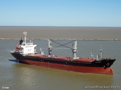
 ERKUL S
Current Status
Where is the vessel?
ERKUL S is currently in 10 nm W of GELENDZHIK, based on AIS data received about 1d ago.
Latest AIS update:
Current position: 44.51110° N, 37.82316° E (10 nm W of GELENDZHIK)
Average speed (last 7 days): Loading…
Average speed (last 30 days): Loading…
Vessel profile: ERKUL S is a General Cargo Ship with dimensions 21m x 128m.
This page combines live AIS, route history, probable destination signals, nearby traffic, and port activity for practical vessel monitoring.
The current position of vessel ERKUL S is 44.51110 lat / 37.82316 lng. Updated: 2026-04-10 07:37:09 UTCNearest reference points:
- Near GELENDZHIK
- Near Novorossiysk
- 20 nm S of Cpc Terminal
Currently sailing under the flag of Panama ![]()
ERKUL S built in 1999 year
Deadweight:
13347 tDetails:
Live Vessel ERKUL S Analytics (details, animations, etc.)
Recent AIS points (UTC):
2026-04-10 01:58:29 UTC · 44.58185, 38.10945 · SOG 5.6 kn · COG -1°2026-04-10 02:57:41 UTC · 44.50141, 38.13698 · SOG 6.5 kn · COG -1°
2026-04-10 05:07:54 UTC · 44.72885, 37.61254 · SOG 11.5 kn · COG -1°
2026-04-10 07:37:09 UTC · 44.51110, 37.82316 · SOG 1.2 kn · COG -1°