 vesseltracker.com
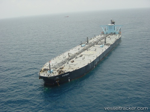
 Armada Olombendo
Current Status
Where is the vessel?
Armada Olombendo is currently in Near Armada Olombendo FPSO, based on AIS data received about 1h ago.
Latest AIS update:
Current position: 6.06877° S, 11.35678° E (Near Armada Olombendo FPSO)
Average speed (last 7 days): Loading…
Average speed (last 30 days): Loading…
Vessel profile: Armada Olombendo is a Fpso Tanker with dimensions 380m x 58m.
This page combines live AIS, route history, probable destination signals, nearby traffic, and port activity for practical vessel monitoring.
The current position of vessel Armada Olombendo is -6.06877 lat / 11.35678 lng. Updated: 2026-03-28 12:28:42 UTCNearest reference points:
- Near N'Kossa Terminal
- 11 nm W of Cabinda
- Near SOYO
Currently sailing under the flag of Marshall Is ![]()
Armada Olombendo built in 1999 year
Deadweight:
301963 tDetails:
Live Vessel Armada Olombendo Analytics (details, animations, etc.)
Recent AIS points (UTC):
2026-03-28 05:19:51 UTC · -6.07253, 11.35541 · SOG 0 kn · COG 60°2026-03-28 07:25:26 UTC · -6.07264, 11.35543 · SOG 0.2 kn · COG 58°
2026-03-28 09:36:12 UTC · -6.06850, 11.35821 · SOG 0.1 kn · COG 181°
2026-03-28 12:28:42 UTC · -6.06877, 11.35678 · SOG 0 kn · COG 149°