 vesseltracker.com
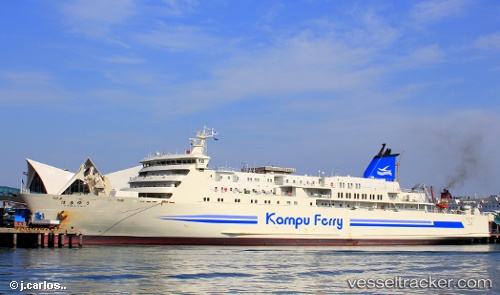
 Hamayuu
Current Status
Where is the vessel?
Hamayuu is currently in Near Busan, based on AIS data received less than 1h ago.
Latest AIS update:
Current position: 35.11715° N, 129.05087° E (Near Busan)
Average speed (last 7 days): Loading…
Average speed (last 30 days): Loading…
Vessel profile: Hamayuu is a Passenger Ro Ro Cargo Ship with dimensions 162m x 24m.
This page combines live AIS, route history, probable destination signals, nearby traffic, and port activity for practical vessel monitoring.
The current position of vessel Hamayuu is 35.11715 lat / 129.05087 lng. Updated: 2026-04-23 04:02:10 UTCNearest reference points:
- Near Busan
- Near Gamcheon/Busan
- Near Gijang-gun/Busan
Currently sailing under the flag of Japan ![]()
Hamayuu built in 1998 year
Deadweight:
4045 tDetails:
Live Vessel Hamayuu Analytics (details, animations, etc.)
Recent AIS points (UTC):
2026-04-22 22:22:09 UTC · 35.11686, 129.05096 · SOG 0 kn · COG 308°2026-04-22 23:44:56 UTC · 35.11707, 129.05083 · SOG 0 kn · COG 307°
2026-04-23 01:23:39 UTC · 35.11709, 129.05081 · SOG 0.1 kn · COG 308°
2026-04-23 04:02:10 UTC · 35.11715, 129.05087 · SOG 0.1 kn · COG 307°