 vesseltracker.com
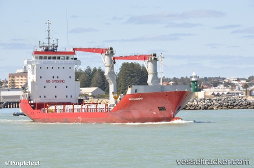
 TAL STAR
Current Status
Where is the vessel?
TAL STAR is currently in Near Kalianak Barat, based on AIS data received about 1h ago.
Latest AIS update:
Current position: 7.18049° S, 112.69399° E (Near Kalianak Barat)
Average speed (last 7 days): Loading…
Average speed (last 30 days): Loading…
Vessel profile: TAL STAR is a General Cargo Ship with dimensions 13m x 93m.
This page combines live AIS, route history, probable destination signals, nearby traffic, and port activity for practical vessel monitoring.
The current position of vessel TAL STAR is -7.18049 lat / 112.69399 lng. Updated: 2026-04-17 17:57:36 UTCNearest reference points:
- Near Kalianak Barat
- Near GRESIK
- Near Gresik, Java
Currently sailing under the flag of Indonesia ![]()
TAL STAR built in 1998 year
Deadweight:
3480 tDetails:
Live Vessel TAL STAR Analytics (details, animations, etc.)
Recent AIS points (UTC):
2026-04-17 12:00:56 UTC · -7.18134, 112.69557 · SOG 0 kn · COG -1°2026-04-17 13:38:26 UTC · -7.18196, 112.69580 · SOG 0.8 kn · COG -1°
2026-04-17 15:46:26 UTC · -7.18128, 112.69436 · SOG 0.2 kn · COG -1°
2026-04-17 17:57:36 UTC · -7.18049, 112.69399 · SOG 0.1 kn · COG -1°