 vesseltracker.com
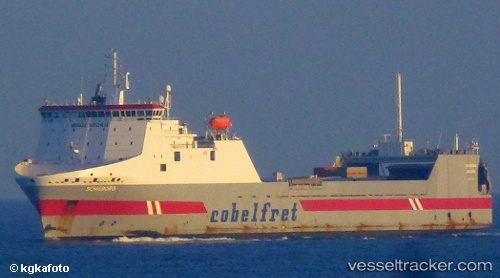
 Belgia Seaways
Current Status
Where is the vessel?
Belgia Seaways is currently in 80 nm NW of CEDEIRA, based on AIS data received less than 1h ago.
Latest AIS update:
Current position: 44.83167° N, 8.95167° W (80 nm NW of CEDEIRA)
Average speed (last 7 days): Loading…
Average speed (last 30 days): Loading…
Vessel profile: Belgia Seaways is a Ro Ro Cargo Ship with dimensions 184m x 25m.
This page combines live AIS, route history, probable destination signals, nearby traffic, and port activity for practical vessel monitoring.
The current position of vessel Belgia Seaways is 44.83167 lat / -8.95167 lng. Updated: 2026-04-20 10:53:09 UTCNearest reference points:
- 57 nm S of Boboras
- 30 nm NW of Meiras-Valdoviño
- 15 nm NW of CEDEIRA
Currently sailing under the flag of Lithuania ![]()
Belgia Seaways built in 2000 year
Deadweight:
12457 tDetails:
Live Vessel Belgia Seaways Analytics (details, animations, etc.)
Recent AIS points (UTC):
2026-04-20 07:11:10 UTC · 45.50667, -8.43833 · SOG 12 kn · COG -1°2026-04-20 08:01:32 UTC · 45.36217, -8.55717 · SOG 11.8 kn · COG -1°
2026-04-20 10:22:53 UTC · 44.92900, -8.88183 · SOG 12.8 kn · COG 205°
2026-04-20 10:53:09 UTC · 44.83167, -8.95167 · SOG 12 kn · COG -1°