 vesseltracker.com
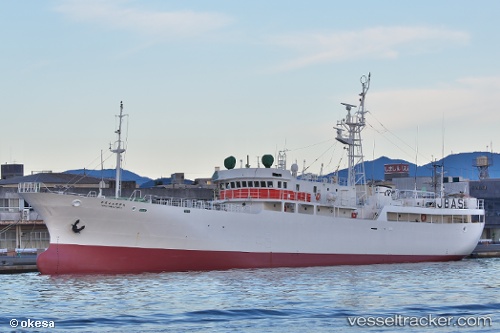
Kineimaru No53
Current StatusWhere is the vessel?
Kineimaru No53 is currently in 372 nm W of Dusky Sound, based on AIS data received about 14h ago.
Latest AIS update:
Current position: 44.19883° S, 157.99500° E (372 nm W of Dusky Sound)
Average speed (last 7 days): Loading…
Average speed (last 30 days): Loading…
Vessel profile: Kineimaru No53 is a Fishing Vessel with dimensions 9m x 51m.
This page combines live AIS, route history, probable destination signals, nearby traffic, and port activity for practical vessel monitoring.
The current position of vessel Kineimaru No53 is -44.19883 lat / 157.99500 lng. Updated: 2026-04-10 07:12:29 UTCNearest reference points:
- Open sea, approx. 408 nm off the nearest listed port
- Open sea, approx. 410 nm off the nearest listed port
- Open sea, approx. 401 nm off the nearest listed port
Details:
Live Vessel Kineimaru No53 Analytics (details, animations, etc.)
Recent AIS points (UTC):
2026-04-10 02:32:01 UTC · -44.18583, 157.55682 · SOG 7.5 kn · COG 100°2026-04-10 03:31:29 UTC · -44.19550, 157.65199 · SOG 7.4 kn · COG 80°
2026-04-10 06:02:55 UTC · -44.19400, 157.91318 · SOG 6.3 kn · COG 101°
2026-04-10 07:12:29 UTC · -44.19883, 157.99500 · SOG 5.5 kn · COG 17°