 vesseltracker.com
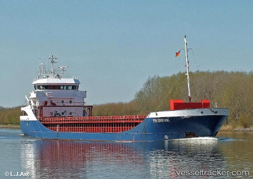
Vessel Fri Brevik IMO: 9190183, MMSI: 209488000 Multi Purpose Carrier
UTC, 56.64400, 4.20850, course: 198, speed: 1.1
UTC, 56.64317, 4.20667, course: 349, speed: 3.5
2026-03-24 13:58:59 UTC, 56.64317, 4.20667, course: 349, speed: 3.5
Live Vessel Fri Brevik Analytics (details, animations, etc.)
Live AIS position: UTC. 23 nm SW of Lachassagne), updated 2026-03-24 13:58:59 UTC.Find the position of the vessel Fri Brevik on the map. The latter are known coordinates and path.
marine traffic ship tracker show on live map
The current position of vessel Fri Brevik is 56.64317 lat / 4.20667 lng. Updated: 2026-03-24 13:58:59 UTCCurrently sailing under the flag of Cyprus
Fri Brevik built in 2001 year
Deadweight:
3771 tDetails:
Last coordinates of the vessel:
UTC, 56.34357, 4.04938, course: 12, speed: 10.8UTC, 56.64400, 4.20850, course: 198, speed: 1.1
UTC, 56.64317, 4.20667, course: 349, speed: 3.5
2026-03-24 13:58:59 UTC, 56.64317, 4.20667, course: 349, speed: 3.5