 vesseltracker.com
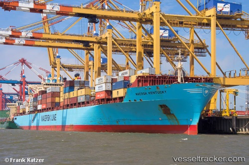
Maersk Kentucky
Current StatusWhere is the vessel?
Maersk Kentucky is currently in 37 nm SE of SUR, based on AIS data received about 19h ago.
Latest AIS update:
Current position: 22.19061° N, 60.06444° E (37 nm SE of SUR)
Average speed (last 7 days): Loading…
Average speed (last 30 days): Loading…
Vessel profile: Maersk Kentucky is a Container Ship with dimensions 32m x 292m.
This page combines live AIS, route history, probable destination signals, nearby traffic, and port activity for practical vessel monitoring.
The current position of vessel Maersk Kentucky is 22.19061 lat / 60.06444 lng. Updated: 2026-04-04 20:30:19 UTCNearest reference points:
- 52 nm NE of SUR
- 23 nm NE of Qalhat
- 90 nm SE of SUR
Details:
Live Vessel Maersk Kentucky Analytics (details, animations, etc.)
Recent AIS points (UTC):
2026-04-04 15:26:01 UTC · 20.84432, 59.55739 · SOG 16.5 kn · COG 20°2026-04-04 18:04:01 UTC · 21.53714, 59.81806 · SOG 16.9 kn · COG 19°
2026-04-04 20:30:19 UTC · 22.19061, 60.06444 · SOG 17.4 kn · COG 9°
2026-04-04 20:30:19 UTC · 22.19061, 60.06444 · SOG 17.4 kn · COG 9°