 vesseltracker.com
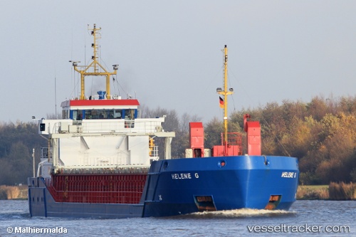
Vessel Helene G IMO: 9195406, MMSI: 304021000 Multi Purpose Carrier
UTC, 57.73830, 12.00012, course: 21, speed: 0
UTC, 57.73835, 12.00027, course: 20, speed: 0
2026-03-01 17:36:07 UTC, 57.73840, 12.00015, course: 21, speed: 0
Live AIS position:
UTC. Near Sävedalen),
updated 2026-03-01 17:36:07 UTC.
Find the position of the vessel Helene G on the map. The latter are known coordinates and path.
marine traffic ship tracker show on live map
The current position of vessel Helene G is 57.73840 lat / 12.00015 lng. Updated: 2026-03-01 17:36:07 UTCCurrently sailing under the flag of Antigua Barbuda
Helene G built in 2001 year
Deadweight:
3156 tDetails:
Last coordinates of the vessel:
UTC, 57.73817, 12.00002, course: 20, speed: 0UTC, 57.73830, 12.00012, course: 21, speed: 0
UTC, 57.73835, 12.00027, course: 20, speed: 0
2026-03-01 17:36:07 UTC, 57.73840, 12.00015, course: 21, speed: 0