 vesseltracker.com
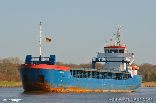
 SVEALAND
Current Status
Where is the vessel?
SVEALAND is currently in 34 nm W of PENICHE, based on AIS data received about 1h ago.
Latest AIS update:
Current position: 39.43107° N, 10.09324° W (34 nm W of PENICHE)
Average speed (last 7 days): Loading…
Average speed (last 30 days): Loading…
Vessel profile: SVEALAND is a General Cargo with dimensions m x m.
This page combines live AIS, route history, probable destination signals, nearby traffic, and port activity for practical vessel monitoring.
The current position of vessel SVEALAND is 39.43107 lat / -10.09324 lng. Updated: 2026-04-10 00:31:40 UTCNearest reference points:
- 18 nm W of Colares
- Near PENICHE
- Near CASCAIS
Currently sailing under the flag of Antigua and Barbuda ![]()
Details:
Live Vessel SVEALAND Analytics (details, animations, etc.)
Recent AIS points (UTC):
2026-04-09 18:12:50 UTC · 40.34473, -10.09477 · SOG 8.8 kn · COG -1°2026-04-09 19:18:30 UTC · 40.18833, -10.09666 · SOG 8 kn · COG -1°
2026-04-09 21:25:20 UTC · 39.88101, -10.10785 · SOG 8.6 kn · COG 178°
2026-04-10 00:31:40 UTC · 39.43107, -10.09324 · SOG 8.5 kn · COG 182°