 vesseltracker.com
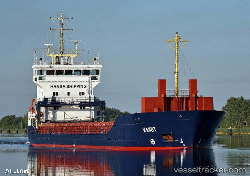
 KAIRIT
Current Status
Where is the vessel?
KAIRIT is currently in 30 nm N of Town Quays/Drogheda, based on AIS data received about 1h ago.
Latest AIS update:
Current position: 54.17638° N, 6.02710° E (30 nm N of Town Quays/Drogheda)
Average speed (last 7 days): Loading…
Average speed (last 30 days): Loading…
Vessel profile: KAIRIT is a General Cargo with dimensions m x m.
This page combines live AIS, route history, probable destination signals, nearby traffic, and port activity for practical vessel monitoring.
The current position of vessel KAIRIT is 54.17638 lat / 6.02710 lng. Updated: 2026-04-13 05:05:27 UTCNearest reference points:
- 14 nm NW of Town Quays/Drogheda
- Near Borkum
- Near Hempens
Currently sailing under the flag of Antigua and Barbuda ![]()
Details:
Live Vessel KAIRIT Analytics (details, animations, etc.)
Recent AIS points (UTC):
2026-04-12 23:28:12 UTC · 54.11508, 7.75645 · SOG 12.1 kn · COG 304°2026-04-13 01:27:28 UTC · 54.20352, 7.12668 · SOG 11.3 kn · COG 271°
2026-04-13 04:06:07 UTC · 54.19935, 6.31640 · SOG 10.2 kn · COG 266°
2026-04-13 05:05:27 UTC · 54.17638, 6.02710 · SOG 10.5 kn · COG 260°