 vesseltracker.com
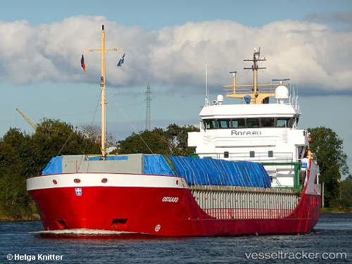
 Ostborg
Current Status
Where is the vessel?
Ostborg is currently in Near Bannesdorf, based on AIS data received about 2h ago.
Latest AIS update:
Current position: 54.52280° N, 11.37898° E (Near Bannesdorf)
Average speed (last 7 days): Loading…
Average speed (last 30 days): Loading…
Vessel profile: Ostborg is a Multi Purpose Carrier with dimensions 89m x 12m.
This page combines live AIS, route history, probable destination signals, nearby traffic, and port activity for practical vessel monitoring.
The current position of vessel Ostborg is 54.52280 lat / 11.37898 lng. Updated: 2026-03-31 07:27:02 UTCNearest reference points:
- Near BURGSTAAKEN
- Near Grossenbrode
- Near Reersoe
Currently sailing under the flag of Netherlands ![]()
Ostborg built in 2001 year
Deadweight:
3792 tDetails:
Live Vessel Ostborg Analytics (details, animations, etc.)
Recent AIS points (UTC):
2026-03-31 02:00:48 UTC · 54.36615, 10.14098 · SOG 0 kn · COG 105°2026-03-31 03:26:39 UTC · 54.47089, 10.28138 · SOG 8.1 kn · COG 25°
2026-03-31 06:17:19 UTC · 54.58034, 11.04499 · SOG 10.9 kn · COG 85°
2026-03-31 07:27:02 UTC · 54.52280, 11.37898 · SOG 10.8 kn · COG 116°