 vesseltracker.com
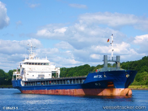
 Antje K
Current Status
Where is the vessel?
Antje K is currently in Near Bahrenfeld, based on AIS data received less than 1h ago.
Latest AIS update:
Current position: 53.53386° N, 9.96075° E (Near Bahrenfeld)
Average speed (last 7 days): Loading…
Average speed (last 30 days): Loading…
Vessel profile: Antje K is a Multi Purpose Carrier with dimensions 90m x 15m.
This page combines live AIS, route history, probable destination signals, nearby traffic, and port activity for practical vessel monitoring.
The current position of vessel Antje K is 53.53386 lat / 9.96075 lng. Updated: 2026-03-29 04:16:50 UTCNearest reference points:
- Near Bahrenfeld
- Near Hamburg-Mitte
- Near Allermöhe
Currently sailing under the flag of Netherlands ![]()
Antje K built in 2002 year
Deadweight:
4247 tDetails:
Live Vessel Antje K Analytics (details, animations, etc.)
Recent AIS points (UTC):
2026-03-28 21:35:39 UTC · 53.51810, 9.94667 · SOG 0 kn · COG 290°2026-03-29 00:13:21 UTC · 53.53388, 9.96072 · SOG 0 kn · COG 304°
2026-03-29 01:22:21 UTC · 53.53387, 9.96072 · SOG 0 kn · COG 304°
2026-03-29 04:16:50 UTC · 53.53386, 9.96075 · SOG 0 kn · COG 304°