 vesseltracker.com
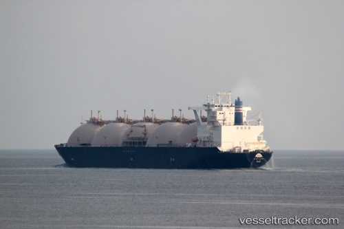
 Lng Jamal
Current Status
Where is the vessel?
Lng Jamal is currently in 19 nm E of Quoin Island, based on AIS data received about 16d ago.
Latest AIS update:
Current position: 26.58844° N, 56.86513° E (19 nm E of Quoin Island)
Average speed (last 7 days): Loading…
Average speed (last 30 days): Loading…
Vessel profile: Lng Jamal is a Lng Tanker with dimensions 290m x 46m.
This page combines live AIS, route history, probable destination signals, nearby traffic, and port activity for practical vessel monitoring.
The current position of vessel Lng Jamal is 26.58844 lat / 56.86513 lng. Updated: 2026-04-05 08:54:49 UTCNearest reference points:
- Near LARAK
- Near QUESHM
- Near SHAHID BAHONAR
Currently sailing under the flag of Japan ![]()
Lng Jamal built in 2000 year
Deadweight:
72692 tDetails:
Live Vessel Lng Jamal Analytics (details, animations, etc.)
Recent AIS points (UTC):
2026-04-05 08:54:49 UTC · 26.58844, 56.86513 · SOG 11.2 kn · COG 166°