 vesseltracker.com
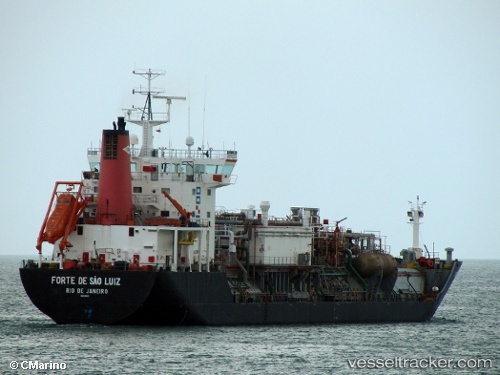
 FORTE DE SAO LUIZ
Current Status
Where is the vessel?
FORTE DE SAO LUIZ is currently in 38 nm NE of Icapuí, based on AIS data received about 6h ago.
Latest AIS update:
Current position: 4.32167° S, 36.83667° W (38 nm NE of Icapuí)
Average speed (last 7 days): Loading…
Average speed (last 30 days): Loading…
Vessel profile: FORTE DE SAO LUIZ is a Lpg Tanker with dimensions m x m.
This page combines live AIS, route history, probable destination signals, nearby traffic, and port activity for practical vessel monitoring.
The current position of vessel FORTE DE SAO LUIZ is -4.32167 lat / -36.83667 lng. Updated: 2026-04-10 07:14:34 UTCNearest reference points:
- 20 nm E of Natal
- 28 nm N of Pecém Pt/São Gonçalo do Amarante
Details:
Live Vessel FORTE DE SAO LUIZ Analytics (details, animations, etc.)
Recent AIS points (UTC):
2026-04-10 02:04:40 UTC · -4.11812, -37.48292 · SOG 7.9 kn · COG 108°2026-04-10 03:24:08 UTC · -4.15212, -37.31286 · SOG 7.8 kn · COG 105°
2026-04-10 05:59:59 UTC · -4.26567, -36.99307 · SOG 7.9 kn · COG 104°
2026-04-10 07:14:34 UTC · -4.32167, -36.83667 · SOG 8 kn · COG -1°