 vesseltracker.com
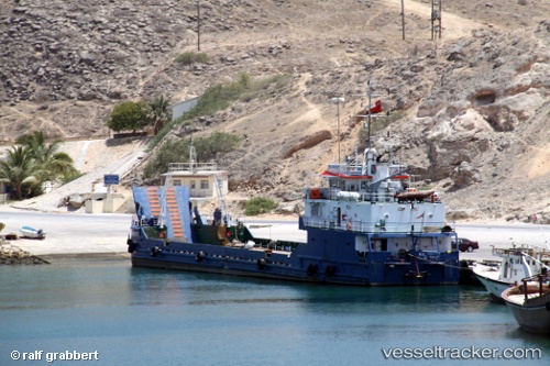
Halaniyat
Current StatusWhere is the vessel?
Halaniyat is currently in 20 nm E of Mina Raysut, based on AIS data received less than 1h ago.
Latest AIS update:
Current position: 17.03147° N, 54.36334° E (20 nm E of Mina Raysut)
Average speed (last 7 days): Loading…
Average speed (last 30 days): Loading…
Vessel profile: Halaniyat is a Landing Craft with dimensions 12m x 63m.
This page combines live AIS, route history, probable destination signals, nearby traffic, and port activity for practical vessel monitoring.
The current position of vessel Halaniyat is 17.03147 lat / 54.36334 lng. Updated: 2026-04-17 00:19:34 UTCNearest reference points:
- 103 nm S of Port Raysut
- 106 nm S of Port Raysut
- 110 nm NE of Gross Koris
Details:
Live Vessel Halaniyat Analytics (details, animations, etc.)
Recent AIS points (UTC):
2026-04-16 15:33:59 UTC · 17.03147, 54.36337 · SOG 0 kn · COG 12°2026-04-16 16:25:22 UTC · 17.03147, 54.36338 · SOG 0 kn · COG -1°
2026-04-16 20:58:07 UTC · 17.03149, 54.36334 · SOG 0 kn · COG 14°
2026-04-17 00:19:34 UTC · 17.03147, 54.36334 · SOG 0 kn · COG -1°