 vesseltracker.com
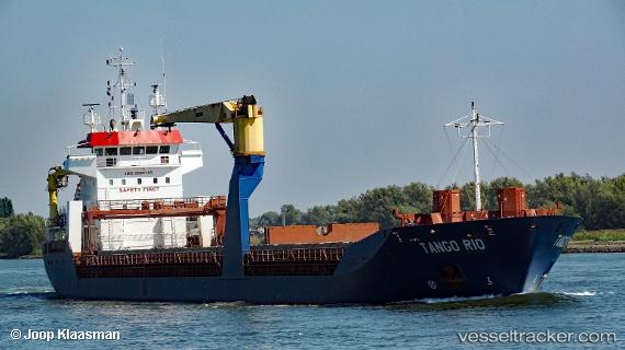
 TANGO RIO
Current Status
Where is the vessel?
TANGO RIO is currently in Near PENDIK, based on AIS data received less than 1h ago.
Latest AIS update:
Current position: 40.84094° N, 29.22396° E (Near PENDIK)
Average speed (last 7 days): Loading…
Average speed (last 30 days): Loading…
Vessel profile: TANGO RIO is a General Cargo with dimensions m x m.
This page combines live AIS, route history, probable destination signals, nearby traffic, and port activity for practical vessel monitoring.
The current position of vessel TANGO RIO is 40.84094 lat / 29.22396 lng. Updated: 2026-04-21 05:56:21 UTCNearest reference points:
- Near TUZLA
- Near PENDIK
- Near Tuzla Free Zone
Currently sailing under the flag of Barbados ![]()
Details:
Live Vessel TANGO RIO Analytics (details, animations, etc.)
Recent AIS points (UTC):
2026-04-21 02:05:17 UTC · 40.84108, 29.22331 · SOG 0 kn · COG 177°2026-04-21 04:02:18 UTC · 40.84099, 29.22386 · SOG 0 kn · COG 201°
2026-04-21 04:43:09 UTC · 40.84117, 29.22319 · SOG 0 kn · COG 175°
2026-04-21 05:56:21 UTC · 40.84094, 29.22396 · SOG 0 kn · COG 209°