 vesseltracker.com
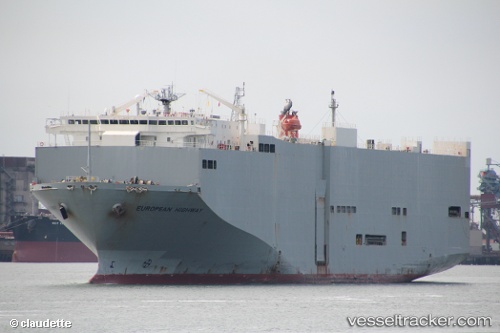
 European Highway
Current Status
Where is the vessel?
European Highway is currently in 63 nm N of Camar Marine Terminal, based on AIS data received about 1h ago.
Latest AIS update:
Current position: 5.27045° S, 112.77027° E (63 nm N of Camar Marine Terminal)
Average speed (last 7 days): Loading…
Average speed (last 30 days): Loading…
Vessel profile: European Highway is a Vehicles Carrier with dimensions 180m x 32m.
This page combines live AIS, route history, probable destination signals, nearby traffic, and port activity for practical vessel monitoring.
The current position of vessel European Highway is -5.27045 lat / 112.77027 lng. Updated: 2026-04-02 21:50:13 UTCNearest reference points:
- 60 nm NW of Camar Marine Terminal
- 50 nm N of Camar Marine Terminal
- 25 nm NE of Camar Marine Terminal
Currently sailing under the flag of Panama ![]()
European Highway built in 1999 year
Deadweight:
15075 tDetails:
Live Vessel European Highway Analytics (details, animations, etc.)
Recent AIS points (UTC):
2026-04-02 14:28:59 UTC · -4.44268, 110.73328 · SOG 17.5 kn · COG 120°2026-04-02 17:23:50 UTC · -4.81772, 111.50997 · SOG 18 kn · COG 113°
2026-04-02 19:37:23 UTC · -5.08925, 112.12572 · SOG 18.3 kn · COG 118°
2026-04-02 21:50:13 UTC · -5.27045, 112.77027 · SOG 18.3 kn · COG 103°