 vesseltracker.com
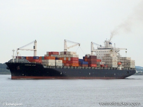
 Carolina Star
Current Status
Where is the vessel?
Carolina Star is currently in 29 nm SE of Nagercoil, based on AIS data received about 1h ago.
Latest AIS update:
Current position: 7.75606° N, 77.69705° E (29 nm SE of Nagercoil)
Average speed (last 7 days): Loading…
Average speed (last 30 days): Loading…
Vessel profile: Carolina Star is a Container Ship with dimensions 243m x 243m.
This page combines live AIS, route history, probable destination signals, nearby traffic, and port activity for practical vessel monitoring.
The current position of vessel Carolina Star is 7.75606 lat / 77.69705 lng. Updated: 2026-03-31 17:44:54 UTCNearest reference points:
- 41 nm S of Nagercoil
- 98 nm S of Nagercoil
- 91 nm S of Nagercoil
Currently sailing under the flag of Liberia ![]()
Carolina Star built in 2000 year
Deadweight:
40125 tDetails:
Live Vessel Carolina Star Analytics (details, animations, etc.)
Recent AIS points (UTC):
2026-03-31 12:02:43 UTC · 7.32137, 78.92522 · SOG 13.1 kn · COG 285°2026-03-31 13:42:34 UTC · 7.45567, 78.57756 · SOG 13.6 kn · COG -1°
2026-03-31 15:32:24 UTC · 7.59337, 78.18099 · SOG 13.9 kn · COG 287°
2026-03-31 17:44:54 UTC · 7.75606, 77.69705 · SOG 13.4 kn · COG 295°