 vesseltracker.com
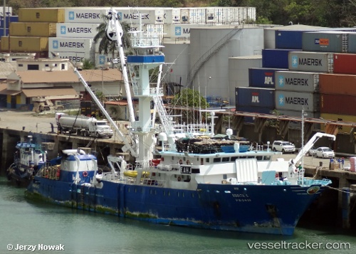
Rosita C
Current StatusWhere is the vessel?
Rosita C is currently in 43 nm NE of Sweeny, based on AIS data received about 3d ago.
Latest AIS update:
Current position: 3.88667° N, 95.05833° W (43 nm NE of Sweeny)
Average speed (last 7 days): Loading…
Average speed (last 30 days): Loading…
Vessel profile: Rosita C is a Fishing Vessel with dimensions 14m x 84m.
This page combines live AIS, route history, probable destination signals, nearby traffic, and port activity for practical vessel monitoring.
The current position of vessel Rosita C is 3.88667 lat / -95.05833 lng. Updated: 2026-04-01 15:06:49 UTCDetails:
Live Vessel Rosita C Analytics (details, animations, etc.)
Recent AIS points (UTC):
2026-04-01 14:20:10 UTC · 3.85061, -94.95117 · SOG 12.3 kn · COG 281°2026-04-01 15:06:49 UTC · 3.88667, -95.05833 · SOG 2 kn · COG -1°
2026-04-01 15:06:49 UTC · 3.88667, -95.05833 · SOG 2 kn · COG -1°
2026-04-01 15:06:49 UTC · 3.88667, -95.05833 · SOG 2 kn · COG -1°