 vesseltracker.com
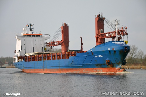
 OCEAN DARIA
Current Status
Where is the vessel?
OCEAN DARIA is currently in 11 nm E of Jingjiang, based on AIS data received less than 1h ago.
Latest AIS update:
Current position: 31.01319° N, 122.61476° E (11 nm E of Jingjiang)
Average speed (last 7 days): Loading…
Average speed (last 30 days): Loading…
Vessel profile: OCEAN DARIA is a General Cargo Ship with dimensions 120m x 20m.
This page combines live AIS, route history, probable destination signals, nearby traffic, and port activity for practical vessel monitoring.
The current position of vessel OCEAN DARIA is 31.01319 lat / 122.61476 lng. Updated: 2026-03-31 20:06:43 UTCNearest reference points:
- 14 nm N of Lü-hua Shan
- Near Lü-hua Shan
- 19 nm NE of Lü-hua Shan
Currently sailing under the flag of Vanuatu ![]()
OCEAN DARIA built in 2000 year
Deadweight:
7458 tDetails:
Live Vessel OCEAN DARIA Analytics (details, animations, etc.)
Recent AIS points (UTC):
2026-03-31 13:26:32 UTC · 31.01555, 122.61336 · SOG 0.1 kn · COG 144°2026-03-31 16:14:28 UTC · 31.01514, 122.61501 · SOG 0.1 kn · COG 249°
2026-03-31 18:05:42 UTC · 31.01403, 122.61547 · SOG 0.5 kn · COG 312°
2026-03-31 20:06:43 UTC · 31.01319, 122.61476 · SOG 0.4 kn · COG 334°