 vesseltracker.com
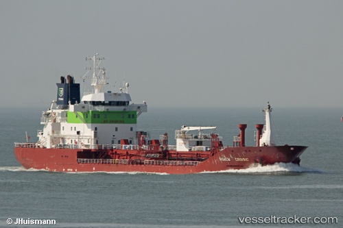
 KARRUCA
Current Status
Where is the vessel?
KARRUCA is currently in 39 nm NW of Casablanca, based on AIS data received about 2h ago.
Latest AIS update:
Current position: 34.15500° N, 8.02333° W (39 nm NW of Casablanca)
Average speed (last 7 days): Loading…
Average speed (last 30 days): Loading…
Vessel profile: KARRUCA is a Chemical/Oil Products Tanker with dimensions 112m x 112m.
This page combines live AIS, route history, probable destination signals, nearby traffic, and port activity for practical vessel monitoring.
The current position of vessel KARRUCA is 34.15500 lat / -8.02333 lng. Updated: 2026-03-26 18:15:04 UTCNearest reference points:
- 54 nm N of El Jadida
- Near Mohammedia
- 44 nm NW of El Jadida
Currently sailing under the flag of Turkey ![]()
KARRUCA built in 2001 year
Deadweight:
7721 tDetails:
Live Vessel KARRUCA Analytics (details, animations, etc.)
Recent AIS points (UTC):
2026-03-26 11:47:20 UTC · 35.24596, -7.80769 · SOG 10.6 kn · COG 205°2026-03-26 13:53:57 UTC · 34.90167, -7.92333 · SOG 10 kn · COG -1°
2026-03-26 15:42:40 UTC · 34.58822, -7.94176 · SOG 10.3 kn · COG 182°
2026-03-26 18:15:04 UTC · 34.15500, -8.02333 · SOG 10 kn · COG -1°