 vesseltracker.com
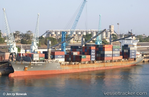
 Altonia
Current Status
Where is the vessel?
Altonia is currently in 20 nm NE of TENES, based on AIS data received about 216d ago.
Latest AIS update:
Current position: 36.77880° N, 1.59671° E (20 nm NE of TENES)
Average speed (last 7 days): Loading…
Average speed (last 30 days): Loading…
Vessel profile: Altonia is a Container Ship with dimensions 184m x 25m.
This page combines live AIS, route history, probable destination signals, nearby traffic, and port activity for practical vessel monitoring.
The current position of vessel Altonia is 36.77880 lat / 1.59671 lng. Updated: 2025-09-16 03:52:21 UTCNearest reference points:
- 17 nm S of Albanchez
- 16 nm NE of Berja
- Near Algiers
Currently sailing under the flag of Liberia ![]()
Altonia built in 2000 year
Deadweight:
22968 tDetails:
Live Vessel Altonia Analytics (details, animations, etc.)
Recent AIS points (UTC):
2025-09-16 03:52:21 UTC · 36.77880, 1.59671 · SOG 74.8 kn · COG 79°