 vesseltracker.com
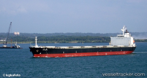
Rui Kang 66
Current StatusWhere is the vessel?
Rui Kang 66 is currently in 30 nm SE of Jiuzhen, based on AIS data received about 1h ago.
Latest AIS update:
Current position: 23.73820° N, 118.14399° E (30 nm SE of Jiuzhen)
Average speed (last 7 days): Loading…
Average speed (last 30 days): Loading…
Vessel profile: Rui Kang 66 is a Bulk Carrier with dimensions 32m x 225m.
This page combines live AIS, route history, probable destination signals, nearby traffic, and port activity for practical vessel monitoring.
The current position of vessel Rui Kang 66 is 23.73820 lat / 118.14399 lng. Updated: 2026-03-26 19:58:51 UTCNearest reference points:
- 18 nm SE of Jiuzhen
- 23 nm S of Xiamen Pt
- 16 nm SE of Jiuzhen
Details:
Live Vessel Rui Kang 66 Analytics (details, animations, etc.)
Recent AIS points (UTC):
2026-03-26 13:58:41 UTC · 24.43052, 118.98940 · SOG 10.4 kn · COG 229°2026-03-26 15:40:01 UTC · 24.23185, 118.75643 · SOG 10.2 kn · COG 228°
2026-03-26 18:11:51 UTC · 23.96272, 118.38395 · SOG 10.3 kn · COG 226°
2026-03-26 19:58:51 UTC · 23.73820, 118.14399 · SOG 10.7 kn · COG 228°