 vesseltracker.com
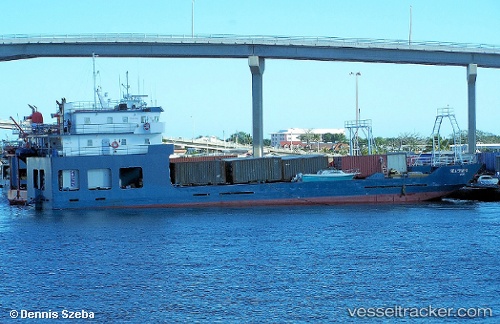
 RELIANCE II
Current Status
Where is the vessel?
RELIANCE II is currently in Near Hialeah, based on AIS data received about 1h ago.
Latest AIS update:
Current position: 25.79757° N, 80.24732° W (Near Hialeah)
Average speed (last 7 days): Loading…
Average speed (last 30 days): Loading…
Vessel profile: RELIANCE II is a General Cargo Ship with dimensions 142m x 22m.
This page combines live AIS, route history, probable destination signals, nearby traffic, and port activity for practical vessel monitoring.
The current position of vessel RELIANCE II is 25.79757 lat / -80.24732 lng. Updated: 2026-04-10 00:13:02 UTCNearest reference points:
- Near Miami
- Near Miami River
- Near Coral Gables
Currently sailing under the flag of Togo ![]()
RELIANCE II built in 1999 year
Deadweight:
750 tDetails:
Live Vessel RELIANCE II Analytics (details, animations, etc.)
Recent AIS points (UTC):
2026-04-09 18:01:51 UTC · 25.79762, -80.24729 · SOG 0 kn · COG -1°2026-04-09 19:59:53 UTC · 25.79767, -80.24728 · SOG 0 kn · COG -1°
2026-04-09 21:23:02 UTC · 25.79759, -80.24729 · SOG 0 kn · COG -1°
2026-04-10 00:13:02 UTC · 25.79757, -80.24732 · SOG 0 kn · COG -1°