 vesseltracker.com
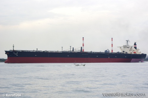
JORDAN
Current StatusWhere is the vessel?
JORDAN is currently in 50 nm NE of Slipi, based on AIS data received about 19h ago.
Latest AIS update:
Current position: 6.60005° N, 107.50348° E (50 nm NE of Slipi)
Average speed (last 7 days): Loading…
Average speed (last 30 days): Loading…
Vessel profile: JORDAN is a Crude Oil Tanker with dimensions m x m.
This page combines live AIS, route history, probable destination signals, nearby traffic, and port activity for practical vessel monitoring.
The current position of vessel JORDAN is 6.60005 lat / 107.50348 lng. Updated: 2026-03-26 10:31:45 UTCNearest reference points:
- 11 nm N of Gombong
- 36 nm SW of Slipi
- 41 nm NW of Brebes
Details:
Live Vessel JORDAN Analytics (details, animations, etc.)
Recent AIS points (UTC):
2026-03-26 10:04:45 UTC · 6.60027, 107.50352 · SOG 0.1 kn · COG 87°2026-03-26 10:31:45 UTC · 6.60005, 107.50348 · SOG 0.1 kn · COG 84°
2026-03-26 10:31:45 UTC · 6.60005, 107.50348 · SOG 0.1 kn · COG 84°
2026-03-26 10:31:45 UTC · 6.60005, 107.50348 · SOG 0.1 kn · COG 84°