 vesseltracker.com
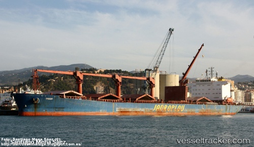
 Trogir
Current Status
Where is the vessel?
Trogir is currently in 91 nm SW of Al Muajjiz, based on AIS data received about 1h ago.
Latest AIS update:
Current position: 22.62455° N, 37.01286° E (91 nm SW of Al Muajjiz)
Average speed (last 7 days): Loading…
Average speed (last 30 days): Loading…
Vessel profile: Trogir is a Bulk Carrier with dimensions 183m x 183m.
This page combines live AIS, route history, probable destination signals, nearby traffic, and port activity for practical vessel monitoring.
The current position of vessel Trogir is 22.62455 lat / 37.01286 lng. Updated: 2026-04-18 08:04:57 UTCNearest reference points:
- 95 nm SW of Al Muajjiz
- 74 nm SW of Yanbu
- 65 nm SW of King Abdullah City
Currently sailing under the flag of Croatia ![]()
Trogir built in 2001 year
Deadweight:
44314 tDetails:
Live Vessel Trogir Analytics (details, animations, etc.)
Recent AIS points (UTC):
2026-04-18 01:49:29 UTC · 22.10724, 37.31775 · SOG 5.5 kn · COG 333°2026-04-18 04:01:27 UTC · 22.29155, 37.20946 · SOG 5.8 kn · COG 331°
2026-04-18 06:12:48 UTC · 22.47123, 37.09835 · SOG 5.4 kn · COG 323°
2026-04-18 08:04:57 UTC · 22.62455, 37.01286 · SOG 5.4 kn · COG 331°