 vesseltracker.com
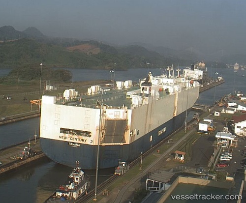
New Century 2
Current StatusWhere is the vessel?
New Century 2 is currently in 99 nm SW of Catalina Island, based on AIS data received about 12h ago.
Latest AIS update:
Current position: 32.17295° N, 119.74724° W (99 nm SW of Catalina Island)
Average speed (last 7 days): Loading…
Average speed (last 30 days): Loading…
Vessel profile: New Century 2 is a Vehicles Carrier with dimensions 32m x 200m.
This page combines live AIS, route history, probable destination signals, nearby traffic, and port activity for practical vessel monitoring.
The current position of vessel New Century 2 is 32.17295 lat / -119.74724 lng. Updated: 2026-04-10 07:51:07 UTCNearest reference points:
- 12 nm SW of Avalon
- 17 nm S of Avalon
- 35 nm W of Del Mar, San Diego
Details:
Live Vessel New Century 2 Analytics (details, animations, etc.)
Recent AIS points (UTC):
2026-04-10 01:37:06 UTC · 31.70555, -121.61328 · SOG 16.5 kn · COG 97°2026-04-10 03:45:25 UTC · 31.75956, -120.95175 · SOG 16.1 kn · COG 67°
2026-04-10 06:08:19 UTC · 32.00252, -120.25415 · SOG 16.1 kn · COG 68°
2026-04-10 07:51:07 UTC · 32.17295, -119.74724 · SOG 16.1 kn · COG 66°