 vesseltracker.com
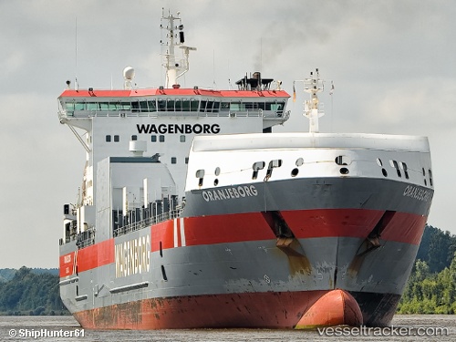
Oranjeborg
Current StatusWhere is the vessel?
Oranjeborg is currently in 43 nm E of Fox River (=riviere-Au-Renard), based on AIS data received less than 1h ago.
Latest AIS update:
Current position: 48.96500° N, 63.28833° W (43 nm E of Fox River (=riviere-Au-Renard))
Average speed (last 7 days): Loading…
Average speed (last 30 days): Loading…
Vessel profile: Oranjeborg is a Ro Ro Cargo Ship with dimensions 26m x 158m.
This page combines live AIS, route history, probable destination signals, nearby traffic, and port activity for practical vessel monitoring.
The current position of vessel Oranjeborg is 48.96500 lat / -63.28833 lng. Updated: 2026-04-19 12:13:17 UTCDetails:
Live Vessel Oranjeborg Analytics (details, animations, etc.)
Recent AIS points (UTC):
2026-04-19 08:17:25 UTC · 49.31319, -64.33258 · SOG 11.5 kn · COG 97°2026-04-19 09:25:24 UTC · 49.23135, -64.02861 · SOG 11.6 kn · COG 121°
2026-04-19 10:43:49 UTC · 49.11128, -63.68585 · SOG 11.8 kn · COG 119°
2026-04-19 12:13:17 UTC · 48.96500, -63.28833 · SOG 13 kn · COG -1°