 vesseltracker.com
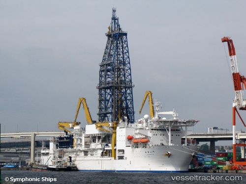
Chikyu
Current StatusWhere is the vessel?
Chikyu is currently in 33 nm S of Niikappu, based on AIS data received about 1h ago.
Latest AIS update:
Current position: 41.82434° N, 142.30067° E (33 nm S of Niikappu)
Average speed (last 7 days): Loading…
Average speed (last 30 days): Loading…
Vessel profile: Chikyu is a Drilling Ship with dimensions 38m x 210m.
This page combines live AIS, route history, probable destination signals, nearby traffic, and port activity for practical vessel monitoring.
The current position of vessel Chikyu is 41.82434 lat / 142.30067 lng. Updated: 2026-04-20 23:22:24 UTCNearest reference points:
- 23 nm NE of SAI
- 11 nm NW of Yokohama, Aomori
- 26 nm E of Hachinohe
Details:
Live Vessel Chikyu Analytics (details, animations, etc.)
Recent AIS points (UTC):
2026-04-20 19:33:53 UTC · 41.82435, 142.30086 · SOG 0 kn · COG 177°2026-04-20 21:31:05 UTC · 41.82434, 142.30081 · SOG 0 kn · COG 180°
2026-04-20 22:12:32 UTC · 41.82435, 142.30081 · SOG 0 kn · COG 180°
2026-04-20 23:22:24 UTC · 41.82434, 142.30067 · SOG 0 kn · COG 190°