 vesseltracker.com
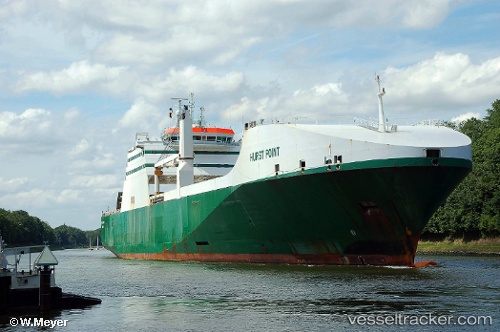
Vessel Hurst Point IMO: 9234068, MMSI: 235500000 Ro Ro Cargo Ship
UTC, -3.88070, 42.07790, course: 280, speed: 8.6
2026-02-07 13:20:17 UTC, -3.90073, 41.88989, course: 279, speed: 9.4
Live AIS position:
UTC. 123 nm E of Kilifi),
updated 2026-02-07 13:20:17 UTC.
Find the position of the vessel Hurst Point on the map. The latter are known coordinates and path.
marine traffic ship tracker show on live map
The current position of vessel Hurst Point is -3.90073 lat / 41.88989 lng. Updated: 2026-02-07 13:20:17 UTCDetails:
Last coordinates of the vessel:
UTC, -3.85570, 42.31445, course: 281, speed: 8.8UTC, -3.88070, 42.07790, course: 280, speed: 8.6
2026-02-07 13:20:17 UTC, -3.90073, 41.88989, course: 279, speed: 9.4