 vesseltracker.com
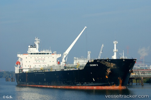
 AZALEA
Current Status
Where is the vessel?
AZALEA is currently in 122 nm S of Kastellorizou (ex Megísti), based on AIS data received about 1h ago.
Latest AIS update:
Current position: 34.12167° N, 29.45500° E (122 nm S of Kastellorizou (ex Megísti))
Average speed (last 7 days): Loading…
Average speed (last 30 days): Loading…
Vessel profile: AZALEA is a Oil/Chemical Tanker with dimensions m x m.
This page combines live AIS, route history, probable destination signals, nearby traffic, and port activity for practical vessel monitoring.
The current position of vessel AZALEA is 34.12167 lat / 29.45500 lng. Updated: 2026-03-27 11:44:05 UTCNearest reference points:
- 108 nm S of Kastellorizou (ex Megísti)
- 129 nm NW of ABU QIR
- 91 nm SE of Polychnitos Lesvou
Currently sailing under the flag of Russia ![]()
Details:
Live Vessel AZALEA Analytics (details, animations, etc.)
Recent AIS points (UTC):
2026-03-27 05:29:50 UTC · 33.37833, 30.22333 · SOG 9 kn · COG -1°2026-03-27 06:48:25 UTC · 33.53500, 30.06833 · SOG 9 kn · COG -1°
2026-03-27 09:25:14 UTC · 33.84667, 29.74333 · SOG 9 kn · COG -1°
2026-03-27 11:44:05 UTC · 34.12167, 29.45500 · SOG 9 kn · COG -1°