 vesseltracker.com
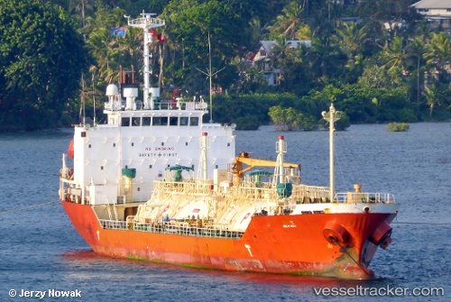
 OCEAN GAS
Current Status
Where is the vessel?
OCEAN GAS is currently in Near Sangam-dong, based on AIS data received about 1h ago.
Latest AIS update:
Current position: 34.84382° N, 127.67520° E (Near Sangam-dong)
Average speed (last 7 days): Loading…
Average speed (last 30 days): Loading…
Vessel profile: OCEAN GAS is a LPG Tanker with dimensions 17m x 99m.
This page combines live AIS, route history, probable destination signals, nearby traffic, and port activity for practical vessel monitoring.
The current position of vessel OCEAN GAS is 34.84382 lat / 127.67520 lng. Updated: 2026-04-17 15:01:49 UTCNearest reference points:
- Near Sangam-dong
- Near Gwangyang
- Near Yeosu
Currently sailing under the flag of Korea (Republic of) ![]()
OCEAN GAS built in 2001 year
Deadweight:
3409 tDetails:
Live Vessel OCEAN GAS Analytics (details, animations, etc.)
Recent AIS points (UTC):
2026-04-17 10:12:07 UTC · 34.84383, 127.67522 · SOG 0 kn · COG -1°2026-04-17 11:02:12 UTC · 34.84400, 127.67517 · SOG 0.1 kn · COG -1°
2026-04-17 12:28:40 UTC · 34.84333, 127.67500 · SOG 0 kn · COG -1°
2026-04-17 15:01:49 UTC · 34.84382, 127.67520 · SOG 0 kn · COG 202°