 vesseltracker.com
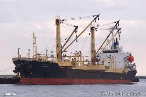
 THURAYA M
Current Status
Where is the vessel?
THURAYA M is currently in Near SUEZ PORT, based on AIS data received about 3h ago.
Latest AIS update:
Current position: 29.93970° N, 32.56027° E (Near SUEZ PORT)
Average speed (last 7 days): Loading…
Average speed (last 30 days): Loading…
Vessel profile: THURAYA M is a General Cargo with dimensions m x m.
This page combines live AIS, route history, probable destination signals, nearby traffic, and port activity for practical vessel monitoring.
The current position of vessel THURAYA M is 29.93970 lat / 32.56027 lng. Updated: 2026-04-19 13:54:38 UTCNearest reference points:
- Near SUEZ PORT
- Near As Suways (Suez)
- Near Bur Ibrahim
Currently sailing under the flag of Saint Kitts and Nevis ![]()
Details:
Live Vessel THURAYA M Analytics (details, animations, etc.)
Recent AIS points (UTC):
2026-04-19 13:26:27 UTC · 29.93968, 32.56028 · SOG 0 kn · COG 96°2026-04-19 13:54:38 UTC · 29.93970, 32.56027 · SOG 0 kn · COG 97°
2026-04-19 13:54:38 UTC · 29.93970, 32.56027 · SOG 0 kn · COG 97°
2026-04-19 13:54:38 UTC · 29.93970, 32.56027 · SOG 0 kn · COG 97°