 vesseltracker.com
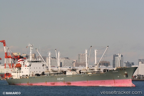
Haru
Current StatusWhere is the vessel?
Haru is currently in 64 nm W of Ponape, based on AIS data received less than 1h ago.
Latest AIS update:
Current position: 6.98667° N, 158.14833° E (64 nm W of Ponape)
Average speed (last 7 days): Loading…
Average speed (last 30 days): Loading…
Vessel profile: Haru is a Refrigerated Cargo Ship with dimensions 16m x 120m.
This page combines live AIS, route history, probable destination signals, nearby traffic, and port activity for practical vessel monitoring.
The current position of vessel Haru is 6.98667 lat / 158.14833 lng. Updated: 2026-04-19 00:01:54 UTCNearest reference points:
- 69 nm W of Ponape
Details:
Live Vessel Haru Analytics (details, animations, etc.)
Recent AIS points (UTC):
2026-04-18 17:28:31 UTC · 6.98660, 158.14964 · SOG 0.1 kn · COG 78°2026-04-18 19:31:32 UTC · 6.98688, 158.14964 · SOG 0 kn · COG 103°
2026-04-18 21:22:30 UTC · 6.98750, 158.14996 · SOG 0 kn · COG 139°
2026-04-19 00:01:54 UTC · 6.98667, 158.14833 · SOG 0 kn · COG -1°