 vesseltracker.com
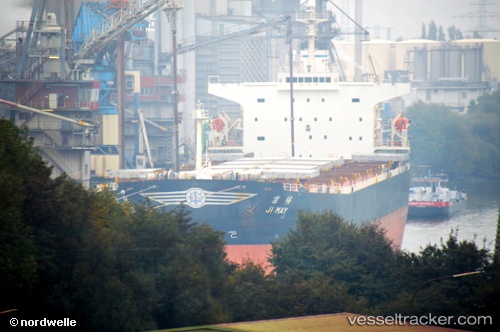
 Levantes
Current Status
Where is the vessel?
Levantes is currently in 84 nm W of Keti Bandar, based on AIS data received less than 1h ago.
Latest AIS update:
Current position: 23.62705° N, 66.00625° E (84 nm W of Keti Bandar)
Average speed (last 7 days): Loading…
Average speed (last 30 days): Loading…
Vessel profile: Levantes is a Bulk Carrier with dimensions 225m x 32m.
This page combines live AIS, route history, probable destination signals, nearby traffic, and port activity for practical vessel monitoring.
The current position of vessel Levantes is 23.62705 lat / 66.00625 lng. Updated: 2026-04-13 17:46:16 UTCNearest reference points:
- 84 nm SW of Keti Bandar
- 16 nm S of Kiamari
- 147 nm SW of Kiamari
Currently sailing under the flag of Marshall Is ![]()
Levantes built in 2001 year
Deadweight:
75900 tDetails:
Live Vessel Levantes Analytics (details, animations, etc.)
Recent AIS points (UTC):
2026-04-13 12:22:07 UTC · 24.02303, 66.01372 · SOG 11.1 kn · COG 125°2026-04-13 13:49:47 UTC · 23.84945, 66.24028 · SOG 11.1 kn · COG 155°
2026-04-13 16:14:08 UTC · 23.61762, 65.98762 · SOG 3.8 kn · COG 255°
2026-04-13 17:46:16 UTC · 23.62705, 66.00625 · SOG 1.3 kn · COG 195°