 vesseltracker.com
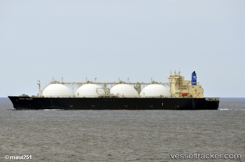
 ARUNIKA JAYA
Current Status
Where is the vessel?
ARUNIKA JAYA is currently in 59 nm N of Bangui, based on AIS data received less than 1h ago.
Latest AIS update:
Current position: 19.47614° N, 120.47932° E (59 nm N of Bangui)
Average speed (last 7 days): Loading…
Average speed (last 30 days): Loading…
Vessel profile: ARUNIKA JAYA is a Lng Tanker with dimensions m x m.
This page combines live AIS, route history, probable destination signals, nearby traffic, and port activity for practical vessel monitoring.
The current position of vessel ARUNIKA JAYA is 19.47614 lat / 120.47932 lng. Updated: 2026-04-20 07:05:54 UTCNearest reference points:
- 66 nm W of Basco
- 106 nm W of Basco
- 132 nm SW of Kaohsiung
Currently sailing under the flag of Indonesia ![]()
Details:
Live Vessel ARUNIKA JAYA Analytics (details, animations, etc.)
Recent AIS points (UTC):
2026-04-20 04:15:55 UTC · 20.14350, 120.78796 · SOG 15.9 kn · COG 217°2026-04-20 04:21:19 UTC · 20.12098, 120.77956 · SOG 16.1 kn · COG 190°
2026-04-20 05:36:47 UTC · 19.81510, 120.64301 · SOG 15.6 kn · COG -1°
2026-04-20 07:05:54 UTC · 19.47614, 120.47932 · SOG 14.8 kn · COG -1°