 vesseltracker.com
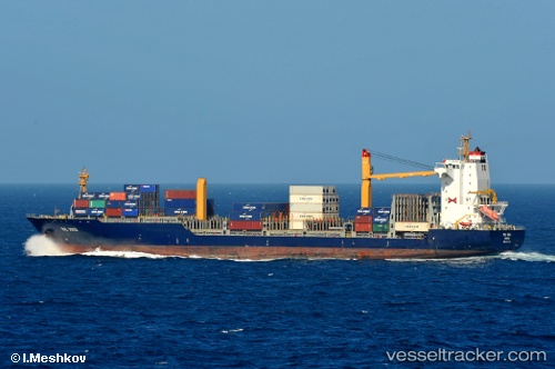
 GROTON
Current Status
Where is the vessel?
GROTON is currently in 12 nm NW of Hendala, based on AIS data received about 1d ago.
Latest AIS update:
Current position: 7.05960° N, 79.68163° E (12 nm NW of Hendala)
Average speed (last 7 days): Loading…
Average speed (last 30 days): Loading…
Vessel profile: GROTON is a Container Ship with dimensions 30m x 212m.
This page combines live AIS, route history, probable destination signals, nearby traffic, and port activity for practical vessel monitoring.
The current position of vessel GROTON is 7.05960 lat / 79.68163 lng. Updated: 2026-04-10 07:34:37 UTCNearest reference points:
- 19 nm SW of Bataduwa
- 67 nm SW of Moratuwa
- 82 nm W of Moratuwa
Currently sailing under the flag of Liberia ![]()
GROTON built in 2002 year
Deadweight:
34554 tDetails:
Live Vessel GROTON Analytics (details, animations, etc.)
Recent AIS points (UTC):
2026-04-10 01:52:37 UTC · 7.05895, 79.68075 · SOG 0.4 kn · COG 334°2026-04-10 03:37:36 UTC · 7.05896, 79.68032 · SOG 0.3 kn · COG 355°
2026-04-10 06:10:33 UTC · 7.05919, 79.68082 · SOG 0.3 kn · COG 323°
2026-04-10 07:34:37 UTC · 7.05960, 79.68163 · SOG 0.5 kn · COG 304°