 vesseltracker.com
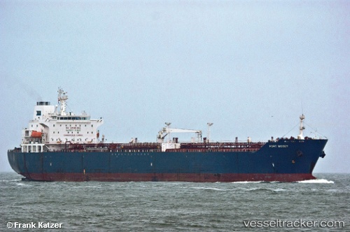
 GREEN LAND
Current Status
Where is the vessel?
GREEN LAND is currently in Near Sekupang, based on AIS data received about 1h ago.
Latest AIS update:
Current position: 1.15769° N, 103.95331° E (Near Sekupang)
Average speed (last 7 days): Loading…
Average speed (last 30 days): Loading…
Vessel profile: GREEN LAND is a Oil/Chemical Tanker with dimensions m x m.
This page combines live AIS, route history, probable destination signals, nearby traffic, and port activity for practical vessel monitoring.
The current position of vessel GREEN LAND is 1.15769 lat / 103.95331 lng. Updated: 2026-04-08 15:35:21 UTCNearest reference points:
- Near BATU AMPAR
- Near Sambu
- Near Sekupang
Currently sailing under the flag of Saint Kitts and Nevis ![]()
Details:
Live Vessel GREEN LAND Analytics (details, animations, etc.)
Recent AIS points (UTC):
2026-04-08 09:34:36 UTC · 1.15844, 103.95332 · SOG 0 kn · COG 70°2026-04-08 11:27:26 UTC · 1.15820, 103.95298 · SOG 0.1 kn · COG 71°
2026-04-08 13:30:02 UTC · 1.15791, 103.95309 · SOG 0 kn · COG 61°
2026-04-08 15:35:21 UTC · 1.15769, 103.95331 · SOG 0 kn · COG 52°